The Super Composite is a near-real-time rainfall viewer for the
South Florida Water Management District (SFWMD). It visualizes
Quantitative Precipitation Estimates (QPE) from selectable gridded datasets
(including SFWMD Gauge-Adjusted Radar Rainfall, GARR, and NOAA
Multi-Radar/Multi-Sensor, MRMS) and lets you overlay independent
rain-gauge observations from a variety of sources for context and verification.
Why “Super Composite”?
The map composites multiple data types and time windows into a single view:
selectable QPE grids (GARR and MRMS), gauge networks, user-selectable accumulation periods,
and regional summaries (Basins, AHED Regions, Forecast Areas, Counties, Chain of Lakes).
The result is a “super” layer that blends raster, point, and polygon information for rapid situational awareness.
Data & Layers
- QPE Datasets (selectable):
- SFWMD GARR: Gauge-adjusted radar rainfall on a 2×2 km grid (typical latency ~30 min).
- NOAA MRMS Pass 1: MRMS QPE on a 1×1 km grid (typical latency ~1 hr).
- NOAA MRMS Pass 2: MRMS QPE on a 1×1 km grid (typical latency ~2 hrs).
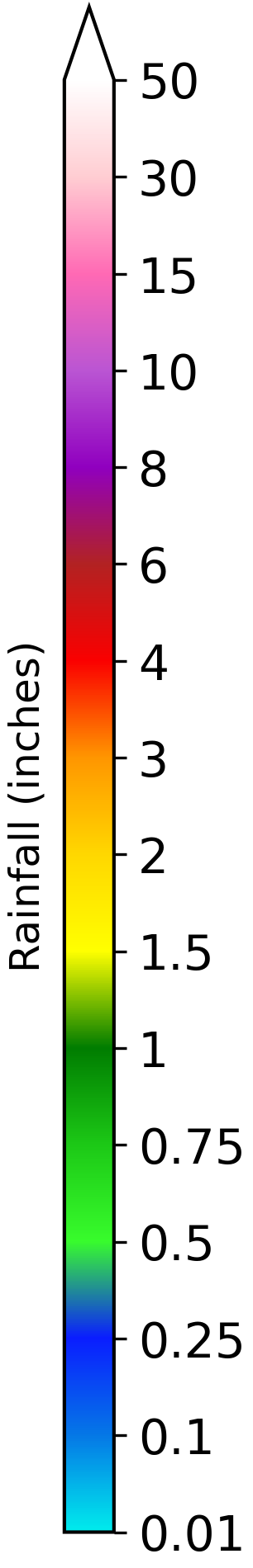
Values are accumulated over the selected time range and shown in inches.
- Rain Gauges (optional): Observed totals from networks including
SFWMD, National Weather Service (NWS), Citizen Weather Observer Program (CWOP),
Florida Automated Weather Network (FAWN), Miami-Dade Water and Sewer (MD), City of Kissimmee (COK),
Florida Atlantic University (FAU), Everglades National Park (ENP), and Archbold (ARCH). Station availability
and latency vary by source.
- Region Statistics: Min/Max/Avg rainfall computed from the selected QPE grid
within selected polygons (Basins, AHED Regions, Forecast Areas, Counties, Chain of Lakes).
An interactive graphic displays within the hover window.
- Reference Layers (optional): Structures and canals for operational context, a radar
overlay for current conditions, plus city labels for orientation.
Timing
The subtitle under the title shows the start and end times of the current accumulation window. The update
time is displayed on the bottom left of the map.
Notes & Limitations
- GARR QPE uses rain gauge data to calibrate radar estimates. Since rain gauges are
the only form of ground truth available, QPE values can update quickly as new gauge data
comes in.
- MRMS is an independent NOAA QPE product and may differ from GARR due to methodology, input data, and processing timelines.
- Grid resolution and typical latency vary by dataset; see the dataset selector metadata for the current selection.
- QPE helps fill gaps between rain gauges, but localized extremes, radar artifacts, or
sparse rain gauge coverage can still introduce errors.
- Not all of the rain gauges shown are used for calibration.
- External rain gauge feeds may be delayed, temporarily unavailable, or inaccurate.
- All values are preliminary and intended for situational awareness only.
Credits
Developed by SFWMD Meteorologists.